The Complete Geographical Map of Qiong Prefecture is a hand-painted map made in 1875 during the late Qing Dynasty. It is now housed in the Library of Congress. With south at the top and north at the bottom, the map presents a panoramic view of Hainan Island, showing its mountains, harbors, towns, military camps, and coastal forts. Unlike an ordinary map, it also illustrates the daily lives of the Li people, including scenes of farming, agarwood collecting, hunting, trading, and other traditional activities, with many accompanied by written notes. Combining geography with local customs, the map provides valuable visual evidence for understanding the history of Hainan and the traditional life and culture of the Li people.
《琼郡地舆全图》为清后期(1875年)彩绘地舆图,现藏于美国国会图书馆。全图采用上南下北的布局,以全景图画式描绘清代琼州府(三州十三县)的自然地理环境和人文风俗景致,图中不仅绘有山川、海港、城寨、营汛、炮台等地理要素,还配绘黎族居处、耕作、采香、渔猎、交易等生活场景,并多附文字说明,是一幅兼具地理信息与民俗记录的地舆风俗图,为研究黎族社会生活、民俗文化及海南历史提供了重要的图像史料。
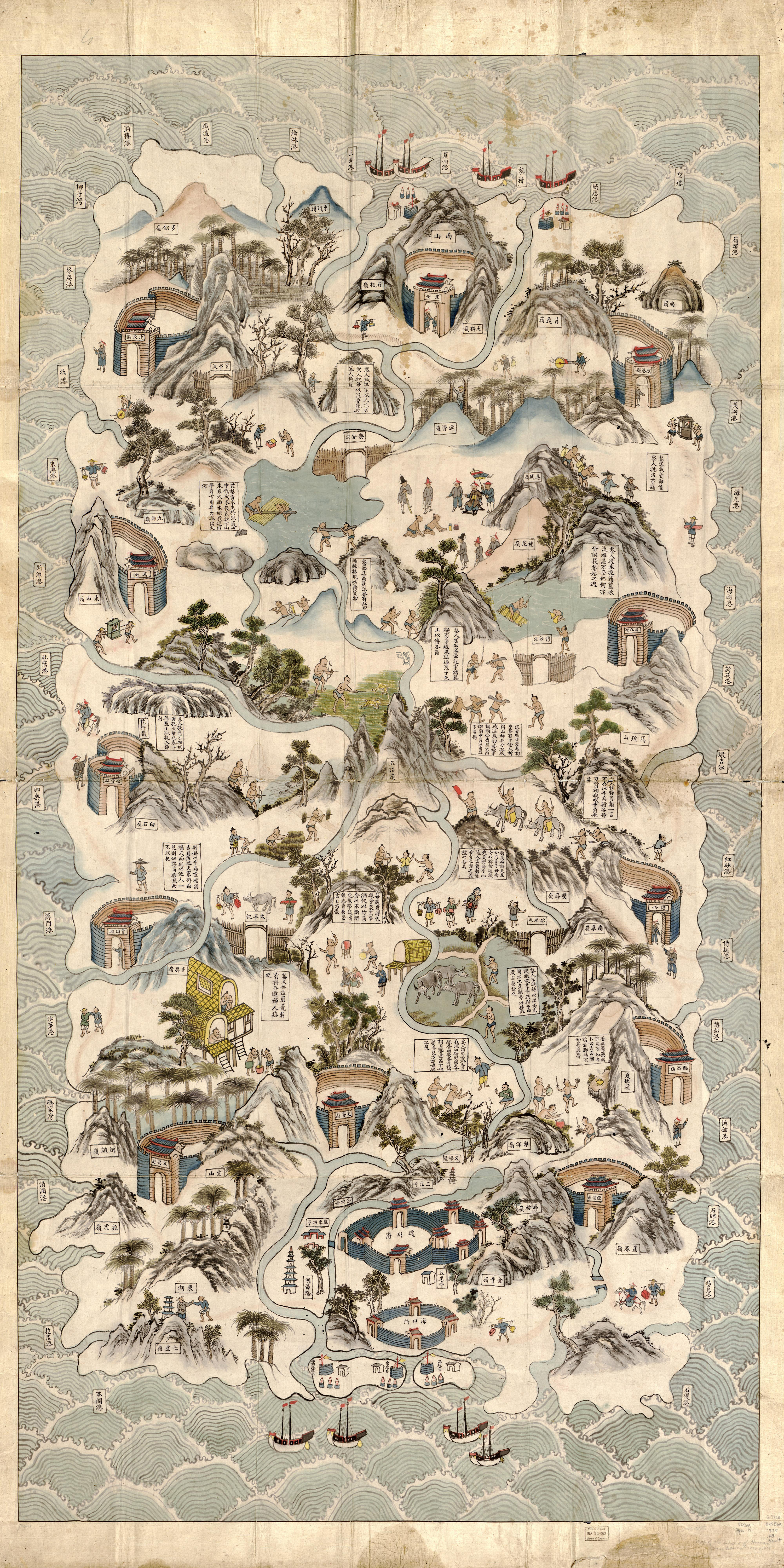
琼郡地舆全图
The Agarwood Collecting Scene is one of the illustrations in the Complete Geographical Map of Qiong Prefecture that depicts the Li people's agarwood-collecting activities. The painting shows several Li people carrying wood and is accompanied by notes explaining how agarwood was believed to form, how it was collected, and the beliefs associated with mountain spirits. Together, the image and text reflect the Li people's agarwood-collecting practices and related cultural beliefs in Qing Dynasty Hainan. It also provide valuable visual material for the study of Hainan's agarwood culture and the Li people's traditional agarwood-collecting practices.
采香图是《琼郡地舆全图》中描绘黎族采香活动的重要场景。画面描绘了数位黎人携带木材而行,并配有关于沉香形成、采集及山神信仰的文字说明。图文结合反映了清代海南黎族采香活动及其相关文化观念,为研究海南沉香文化和黎族传统采香活动提供了珍贵的图像资料。
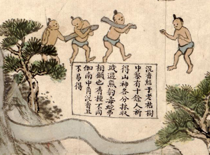
采香图